News Summary
Residents in Greenville and southern Spartanburg are advised to prepare for a severe thunderstorm warning effective until 6:30 a.m. This morning’s storms are moving swiftly at 75 mph with strong winds and lightning expected. Major locations affected include Gastonia, Rock Hill, and Uptown Charlotte. Safety precautions are urged as these storms can cause hazardous conditions, including hydroplaning and flying debris. Stay safe and informed as this weather system passes through.
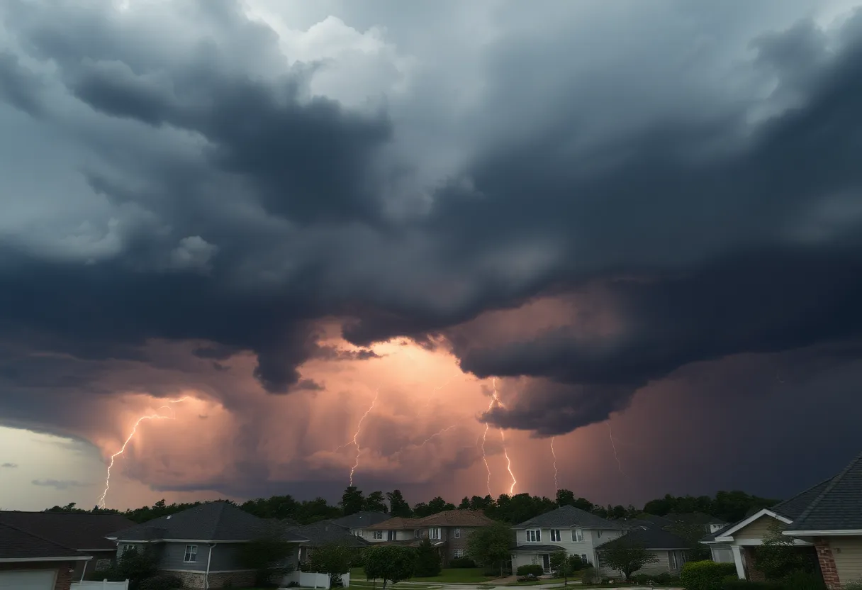
Severe Thunderstorm Warning in Greenville and Southern Spartanburg
Good morning, folks! If you’re waking up in Greenville or the southern parts of Spartanburg, you might want to grab a cup of coffee and hunker down for a bit. As of 6:09 a.m. this fine Sunday, a *Severe Thunderstorm Warning* has been issued that is effective until 6:30 a.m. It appears that the weather gods are planning a rather restless morning for us!
What’s Going On?
Radar is quite busy this morning as we have strong thunderstorms making their way through the area. These storms are currently racing eastward at an impressive speed of 75 mph. They have been tracked from near Spruce Pine all the way down to about 10 miles south of Forest City and 8 miles west of Spartanburg.
The forecast isn’t looking too cozy. Wind gusts could reach up to a hefty 40 mph, which means if you have loose branches in your yard or outdoor furniture, it might be a good time to bring them inside! These gusty winds could easily knock down tree limbs and send unsecured objects tumbling.
Where is this Affecting?
So, who should be paying attention? Well, the alert impacts a number of locations including Gastonia, Rock Hill, Uptown Charlotte, Huntersville, Hickory, Spartanburg, Statesville, Shelby, Lenoir, and Morganton. If you find yourself in these areas, it’s wise to stay informed and be prepared.
Safety Measures
If you’re outside when these storms hit, the wise move is to seek shelter in a solid building. Stay away from windows and doors to keep safe from flying debris—a real concern when those winds pick up speed. If you happen to be in your vehicle, avoid driving during a bad storm and make sure you’re not susceptible to hydroplaning.
What is Hydroplaning?
Hydroplaning can occur when a vehicle slides uncontrollably on wet roads, thanks to water buildup in front of the tire. When water pressure builds up, it forces vehicles to rise and slide on a thin layer of water between the tires and the road. It can make your commute a bit tricky, so proceed with caution if you must venture out during the storms.
Prepare Yourself!
In light of this warning, it is important to stay updated and prepared. Bring in outdoor items, stay indoors if possible, and keep an eye on the weather. The storm may put a damper on plans, but sticking with safety guidelines will ensure a safer outcome for you and your loved ones.
As the skies roar and the winds howl, remember, it’s just Mother Nature showing her might. Stay safe, stay informed, and let’s weather this storm together! We got this, Greenville!
Deeper Dive: News & Info About This Topic
HERE Resources
Severe Storm Causes Flooding and Evacuations in Eastern U.S.
Hughes Fire Sparks Evacuations and I-5 Closures in California
Winter Weather Hits Western North Carolina: School Closures and Delays
Severe Weather Outbreak Causes Tornadoes and Tragedies Across Southern States
Severe Weather Warning: Tornado Watches for Georgia and South Carolina
Greenville Braces for Cold January Weather
Additional Resources
- Fox Carolina: Severe Thunderstorms Affect Parts of Greenville-Spartanburg Area
- Wikipedia: Severe Thunderstorm Warning
- WSPA: Tornado Alert Issued in Upstate
- Google Search: Severe Thunderstorm Warnings
- Greenville Online: Thousands Lose Power in Greenville Thunderstorm
- Google Scholar: Severe Weather Safety
- Myrtle Beach Online: Weather Update
- Encyclopedia Britannica: Thunderstorm